Two new bridges appearing in Preston in 2025. One the new Tram Road Bridge. The other the bridge at East Cliff over the former East Lancs line. It makes for an improved walking experience over the river Ribble in South Ribble.
Below is the new and incomplete Tram Road Bridge viewed from the old East Lancs line.Below is the North Union Bridge over the River Ribble which carries the West Coast Main Line.
The EastLancs Bridge over the River Ribble.
The well tended walk and cycle wayoverthe East Lancs Bridge
The choice is to drop down into the park or go straight ahead to the Railway Station
The ornamental East Lancs Bridge in Miller/Avenham Park
Crossing the ornamental bridge: The choice from the station car park is go up towards East Cliff and into the park or go right and under the new bridge on the path shown above
Another good walk in Preston: Tram Bridge – Harris Institute – Edith Rigby House – St Wilfrids – Harris Museum – Upper Friargate plus bonus places
The word is on the street is the Old Tram Bridge is gone. Time to check it out.
The River Ribble in Preston after demolition of the Old Tram Road Bridge. 4th September 2024
Heading into Avenham Park, up onto the former East Lancs Railway Bridge, now a footpath. Look left, a space where the Tram Bridge was. There’s a digger creating islands for the work on the new bridge. That’s something, a space, after 200 years.
Looking over the other side we see the West Coast Main Line on the North Union Bridge over the River Ribble.
Turning back we see the former Park Hotel ever threatening to be restored. Going straight along the path takes you to a barrier so we turn right and head back down into Avenham Park.
But what happens if we don’t turn back. Skip the next paragraph if you don’t want to know.
It’s good to walk on former railway lines. The track goes towards Bamber Bridge but doesn’t reach there as a footpath. On the way you can turn left to the Capital Centre, or right to Vernon’s Cricket Ground as in Freddie Flintoffs: Fields of Dreams Series 1. You can turn onto the Tram Road and walk back in a triangular track or go further on to Lostock Hall. The rail track passes what was a large gasworks but is now a housing estate before the line comes to Todd Lane. I doubt you can walk past there. It’s years since I walked along there.
Another option is to go down the other side of the bridge to Penwortham. Or go the other way to where the Tram Road bridge works are but can you get past? If you can get past it goes to the Capital Centre or Winery Lane, Walton Le Dale.
Back in the park we walk along the river bank enjoying views of bridges and trees. It’s nice in there.
This riverside avenue of trees looks good in all seasons.
The totem pole which contains a chain to denote the old trams and the steam driven chain that hauled them up the steep bank climbing around 100ft above the bridge. These horse drawn trams(trailers) could carry 2 tons of coal.
The message ‘Tram Bridge. Reviving history. Reconnecting Preston.
The tram bridge opens walks over the river and along the Tram Road. These trams being horse pulled carts on rails between the Leeds Liverpool Canal and the Lancaster Canal. An aqueduct and locks being too expensive. It was started in the 1790s and operated for about 30yrs dragging coal dug in Wigan sent by barge before being dragged by ‘tram’ to Preston for loading onto a barge for Lancaster and Kendal. This was before the railway came to take over the job. Things don’t stop evolving.
The Old Tram Road was a badly maintained dirt track in the 1960s, capable of taking a car if essential. Trains were still running from Blackburn(and further east) and Liverpool over the East Lancs Bridge and track. That route closed to passengers from Bamber Bridge to Preston in 1968 and Todd Lane Junction station closed.
The gasworks would be fired by coal and produced coke and gas. By the time the line closed it was fired by Fuel oil which was shipped by rail for many years until North Sea gas came along and closed the site. Every gas cooker in Britain had to be converted to burn North Sea gas instead of Town Gas. The gasworks lasted from around 1924 to 1970. I used to be able to see the gasometers going up and down across the fields from our back window. The giant gasometers are gone all over Britain.
Here’s a better shot of the former bridge stands in the river and at the far side the first of the workers islands. The new bridge is covered in a previous post on this blog.
Moving on, instead of going up the steep former tram road go a bit further on and see the cannons from Sebastopol on either side of the steps.
Then up to the promenade and the tower building, now flats, maybe apartments.
Halfway along the promenade some interesting looking houses down a side street to the right. Enjoy the architecture.
The Harris Institute. A fine building pending another proposal for use. At this point Avenham Lane changes to Ribblesdale Place a formerly affluent area, now mainly offices.
Ribblesdale Place. A road with some fine houses overlooking the park at the back.
The home of the Reverend Robert Harris and his son Edmund in Ribblesdale Place, Preston.
Ribblesdale Place. The house of the Rev Harris whose son was benefactor the Harris Museum.
The Blue Plaque for the Rev Robert Harris and his son Edmund on the building they lived in at the gates of Avenham Park. Edmund being the benefactor of the Harris buildings in Preston.
On to Winckley Square, Chapel Street. The house of Edith Rigby proposed for a museum to commemorate the Women’s Movement. See the Blue Plaque below.
Blue Plaque in Preston. Edith Rigby. Suffragette. Secretary of Preston Branch Women’s Social and Political Union.
This building looks good in the September sun. The next building is the site of the Preston Catholic College which was the Catholic Grammar School in the not too distant past.
St Wilfrid’s Church. Roman Catholic across the road from the former Catholic College. It’s interior is finer than its exterior. Going into churches in Preston wasn’t something I did but lately there’s been two firsts, both exceeding expectations.
On Winckley Square north side is the former house of Thomas Miller, mill owner and one of the benefactors of Miller Park. See the Blue Plaque below.
On the south side just beyond Winckley Square is another house of a Women’s Movement lady, Beatrice Todd. Blue Plaque below.
Read more about Winckley Square on our website. Click here
In Glovers Court leading to Fishergate is the Wellington pub. It looks better now than it did. Formerly it was very popular with teenagers in the 1960’s as the Beachcomber club was at the Fishergate end.
Booth’s clock bridge on Glovers Court. On the left upstairs used to be a high class fashion shop whose name escapes me. 1960/70’s.
A view along Fishergate the main shopping street in Preston. The banner is for BBC Radio 2 in theP ark. Held in Preston from Friday to Sunday 6th to 8th Septembe 2024. A successful event with big audiences on Moor Park, to the north, and good weather until Sunday when it rained, as it did all over the UK.
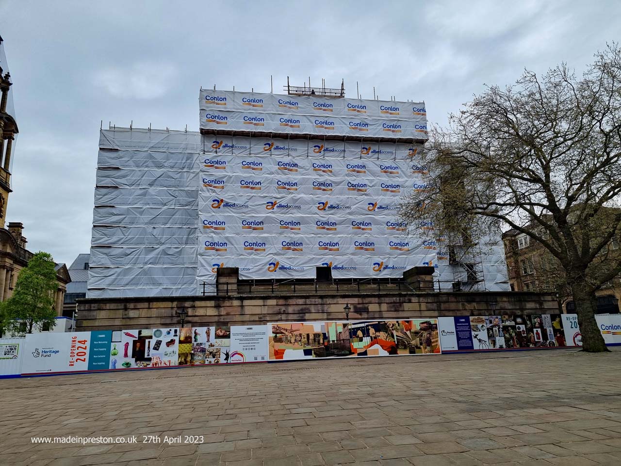
The Harris Museum awaiting re-opening in early 2025. The announcement this week that a major supplier of the update has gone into administration puts a chunk of funding at risk as well as the opening date. Although we can only wait to learn what the administrator and council does.
The best built view in Preston.
Read more about the Harris Museum, Art Gallery and Library on our website. Click here
Another project on hold is the old post office conversion. Plans for a hotel are on hold.
Continuing into Friargate just on the left is the former Boars Head pub looking tired. This was a popular pub.
The Black Horse pub has an interesting interior. It had an old chap with a moustache and a white jacket who waited on in the late 60s.
The Methodist Church on Lune Street. Venue for Preston Historical Society meetings.
The Old Vic across from the Railway Station. Next door is Rise a nice coffee place and sister to the one in the Miller Arcade which also offers food.
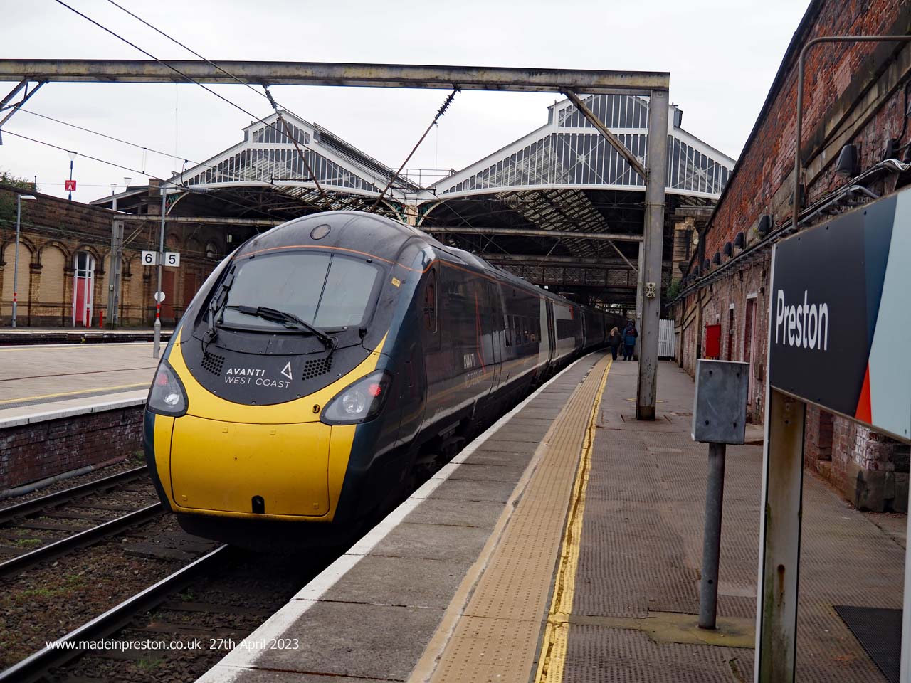
Preston Railway Station from Butler Street. It’s good that Preston kept the prestige of having a real fully covered railway station when all the other towns in Lancashire had their’s knocked down and replaced with large bus type shelters. Perhaps that helped give Preston city status. That and the astounding bus station.
That was a good walk, very enjoyable and thought and memory provoking. Preston has many layers of history and still moves on powered largely by UCLan and payments from students and their demands for youthful life. Keep that youthful life and keep walking.
Read more about the Railways around Preston and the Tram Road on our website. Click here.
A Wednesday walk arriving in Avenham Park, Preston to visit the Pavilion, shown in the first photo. In there are some wallboards explaining the design and work for the new bridge design for the Tram Road Bridge which has flakey concrete. Work is due to start in May.
Passing the Japanese Garden that is on the right going down into the valley of the River Ribble.
Exhibition of the new Tram Bridge design. On display in the Avenham Park Pavilion.
Star of the show: the Tram Road Bridge. Soon to be demolished.
The sign at the Tram Road bridge showing the cycle routes. There are ways to get across as there is a cycle track up onto the East Lancs Bridge.
The East Lancashire railway bridge which you can climb up at each end and walk across it and there is a cycle track up onto the bridge. Once there you walk or cycle along the track bed towards Lostock Hall or The Capital Centre Shopping Centre at Walton Le Dale. To the latter you can cycle along the river bank on either side. The bridge behind being the West Coast Main Line.
The now enclosed shelter. The Belvedere.
The promenade into Avenham Park:
Ribblesdale Place between two of the entrances to Avenham Park.
After some wandering in shops we passed the Old Black Bull on Friargate, next to the Ring Road.
Carrying on towards the centre on Friargate we come to the Town Hall, Cenotaph and Harris Library, Museum and Art Gallery.
Next stop Waterstones, here are the Preston books.
Here are local transport related books. I made a spontaneous purchase afte my wife showed me the book ‘Quizmaster’ about a Burnley pub landlord who achieved some fame creating a pub quiz on line meaing it to be for locals but attracting worldwide teams. Just issued in Hardback.
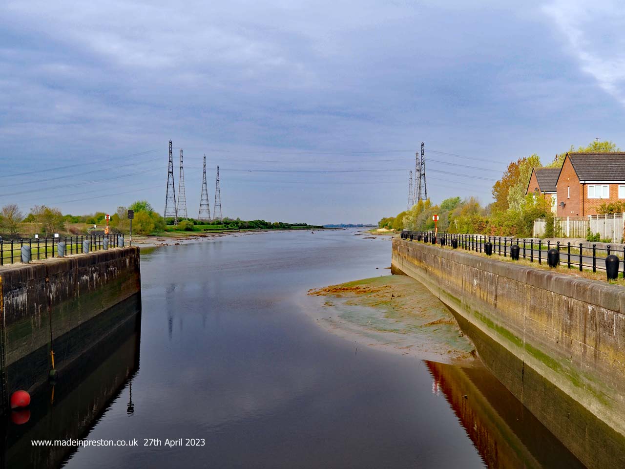
Another walk, this time from a garage at the far end of Preston Docks into the City Centre, about 3 miles each way, more than you’d think. Walking along Chain Caul Way, turning right into Lockside Road to the outer lock gates.
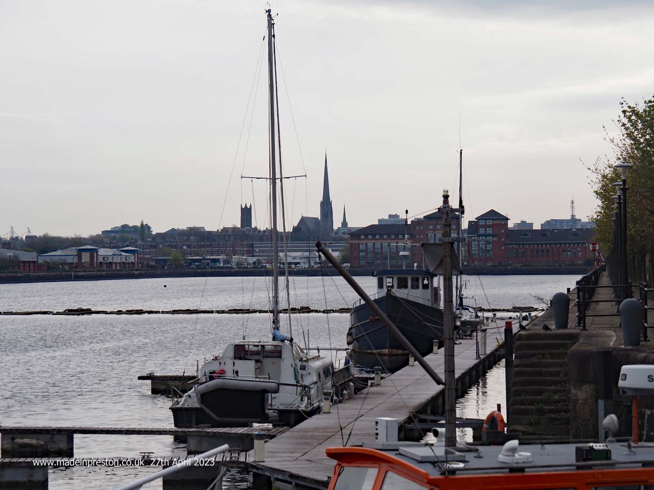
Here’s the view from the lock gates down the river with the tide quite low. It was a bright early morning about 8.30am.The view along the River Ribble from the Port of Preston Basin Locks
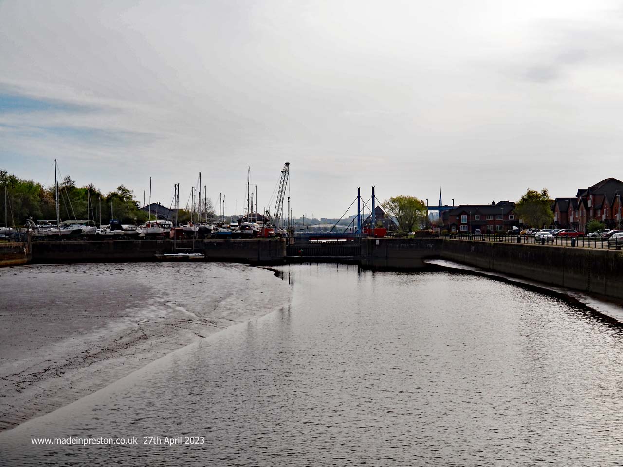
Looking the other way is a view into the docks as a ships crew might have seen it coming in from the river. The basin looks a lot smaller than memories and looks like it needs dredging. Oil ships used to moor here, now the oil comes in by train and it was a bit disappointing to see its load being moved in the opposite direction near the Park and Ride on Strand Road.The view into the Port of Preston from the outer Basin Locks
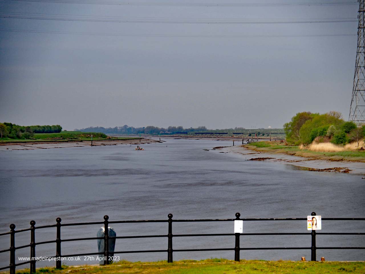
Crossing the lock gates takes you to the Bullnose which protrudes from the dock area creating a junction to the river. At hight tide canal barges turn off to the right at Savick Brook after crossing from the River Douglas, this is part of the passage from the Leeds Liverpool Canal to the Lancaster Canal.The view along the River Ribble from the Bullnose at the far western end of Preston Docks
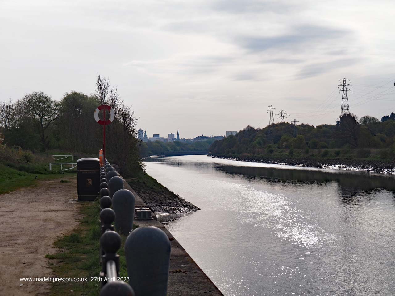
On the river side of the Bullnose is a view into Preston. There used to be ship breakers along there. The river once went through the north of the dock but was diverted when they built it. It has a lot of meanders as it gets into the flatter areas west of Preston and is tidal on a big tide another 4 miles upstream.The view along the River Ribble into Preston from the near the Bullnose at the far western end of Preston Docks
Inside the main dock, which is one of the biggest single dock areas in Britain. A view towards Preston and the 2nd highest steeple in England, St Walburge’s. To the right is the spire of St Peter’s at the University. To the left is the tower of St Marks, now apartments, and on the edge of the river valley.The view inside the main dock at the Port of Preston
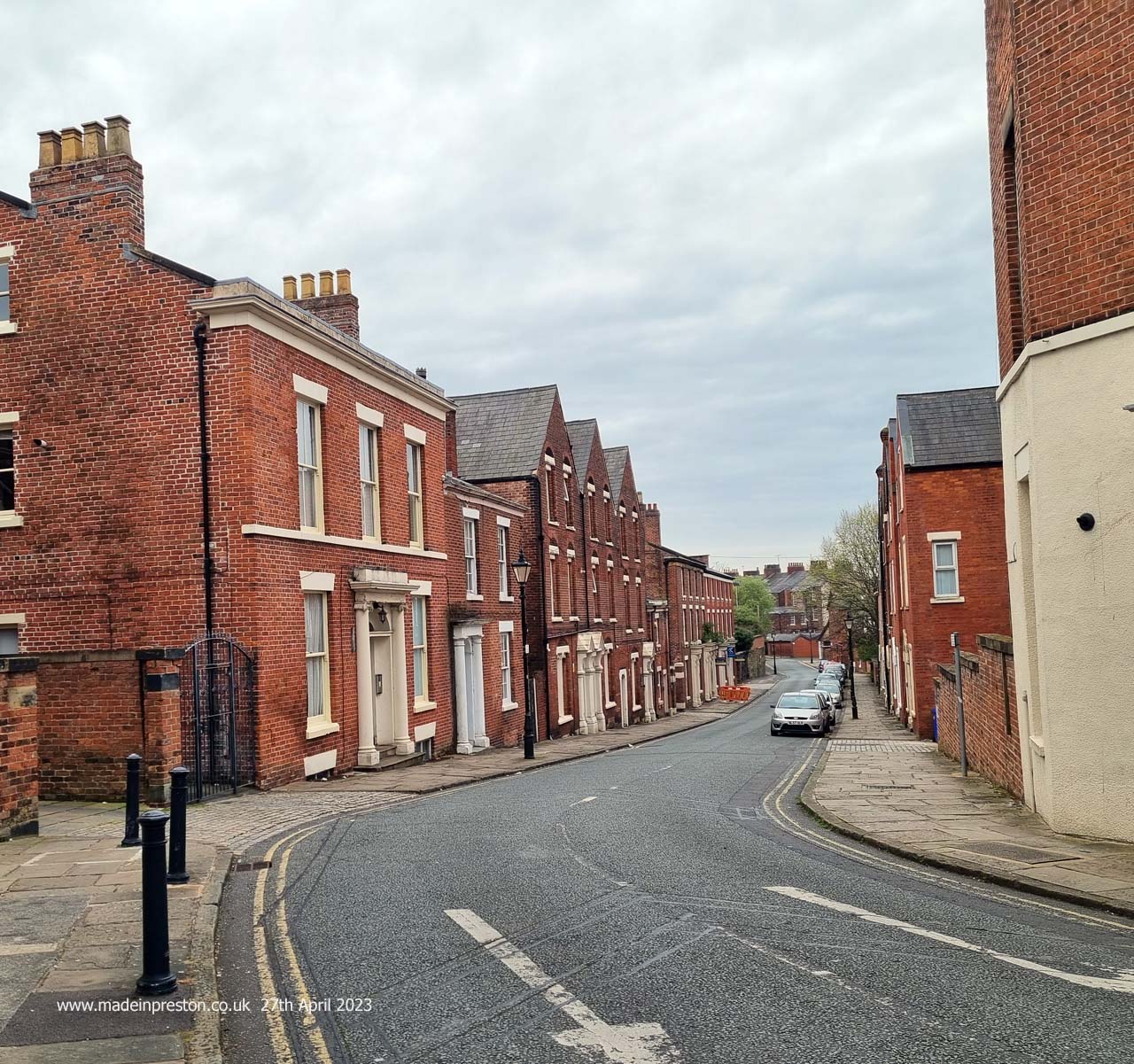
Passing the car dealers on Port Way and past the Park and Ride on Strand Road. Crossing Strand Road and up Hartington Road, left at Christ Church Road up to Bow Lane turning right to Fishergate Hill. Here’s a photo of Walton’s Parade near the station, quite an attractive terrace.Walton’s Parade off Fishergate Hill, Preston
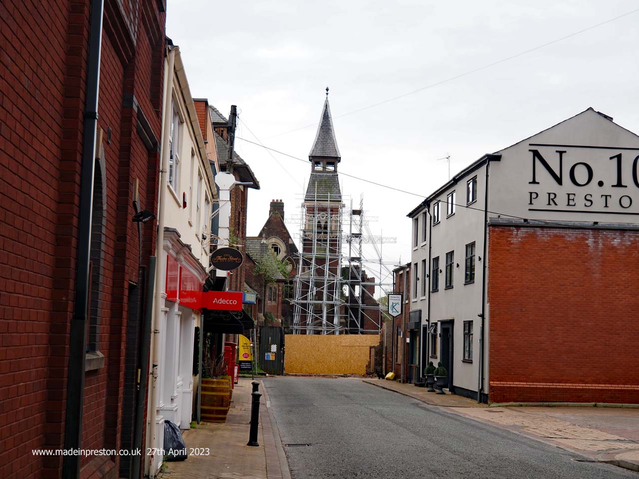
Passing the station and straight on, here is Mount Street former Hospital and Orphanage. The attractive tower will be retained in a new housing development. The remains of Mount Street Hospital, Preston
The Harris is more covered in plastic at every visit, this must be the limit. Due to re-open in 2024 with an expensive refit.The Harris Museum, Art Gallery and Library, Preston, now completely wrapped in plastic during refurbishment
After wandering around a few shops and taking refreshment, time to head back popping onto the station to take a few photographs. Same walk the reverse route althoug there are a few other routes. The only difference was crossing the swing bridge in the docks and using the path on the other side of the basin. 6 miles total up to the station and then wandering round, quite enough.The London train departing at the far northern end of Preston Station
Found a blog today called ‘Save the Ribble’. It’s against the Riverworks project but has a posting dated 15th February where the writer rode the Ribble Tidal Bore and got stuck on mud flats. An enjoyable read with humour reminiscent of Three Men in a Boat.
 Below is the North Union Bridge over the River Ribble which carries the West Coast Main Line.


 The choice from the station car park is go up towards East Cliff and into the park or go right and under the new bridge on the path shown above